How to Get to Eureka Springs: A Complete Transportation Guide
Last updated August 2026. Working out how to get to Eureka Springs starts with a choice between two regional airports or a scenic drive through the Ozarks. Northwest Arkansas Regional Airport (XNA) and Branson Airport (BKG) each sit roughly 45 to 50 miles from downtown. Once you arrive, parking on the town's steep, narrow streets is often the harder part of the trip.
How to Get to Eureka Springs: Quick Answer
Most visitors reach Eureka Springs one of two ways: drive the entire route in a personal car, or fly into a regional airport and rent one for the final leg. Arkansas Tourism and the Eureka Springs tourism office both frame the town as a road-trip destination inside the Ozark Mountains, since no commercial airport sits inside Carroll County itself. If you already have a car, driving in from Fayetteville, Little Rock, or Branson is usually simpler than coordinating a flight and a rental pickup. If you are flying in from farther away, Northwest Arkansas Regional Airport (XNA) generally offers more carrier choice, while Branson Airport (BKG) can shorten the drive when your itinerary already runs through southern Missouri. Either way, plan the final approach separately from the flight or highway leg, since the roads narrow and climb as you get close to town.
- The Road Tripper: drive in from Fayetteville, Little Rock, or Branson on state highways, no rental car needed.
- The Flyer: land at XNA or BKG, then rent a car for the last 45 to 50 miles into town.
- The Weekend Visitor: build the drive into a tight schedule with the weekend getaway plan, so arrival day and departure day both stay short.
Flying to Eureka Springs: XNA vs. Branson Airport (BKG)
Two regional airports serve Eureka Springs, and neither sits close enough to skip a rental car entirely. Northwest Arkansas Regional Airport (XNA), near Fayetteville, typically carries more airline options and a larger bank of rental counters than Branson Airport (BKG). Both are commonly billed as a 45-minute drive from town, but that estimate assumes light traffic and no stops. Budget 60 minutes or more from either airport, since the final stretch runs on two-lane roads through the hills. Branson Airport can still work well if your itinerary already includes Missouri, since its runway sits closer to the scenic northern approach on Highway 65 and Highway 62. For pilots flying themselves in, the Eureka Springs Silver Tea Municipal Airport (4C1) handles private and general aviation traffic directly at the edge of town. It has no commercial service and no rental counter waiting on arrival.
Both regional airports quote a 45-minute drive, but budget 60 minutes or more once you're on the two-lane roads through the hills. The same underestimate shows up on the drive-time page, where Google Maps tends to undercount the final approach's curves.
| Airport | Distance from Eureka Springs | Typical Drive Time | Best For |
|---|---|---|---|
| Northwest Arkansas Regional (XNA) | ~45-50 miles | 60+ minutes | More carriers, more rental options |
| Branson Airport (BKG) | ~45-50 miles | 60+ minutes | Trips already routed through Missouri |
| Eureka Springs Silver Tea Municipal (4C1) | In town | N/A | Private and general aviation only |
Driving to Eureka Springs: Routes From Every Direction
Eureka Springs sits in the Ozark Mountains, and every driving route into town eventually narrows to a two-lane state highway. Coming from regional hubs such as Tulsa, Little Rock, Kansas City, or Springfield, expect a multi-hour drive that ends on hilly, curving roads rather than an interstate exit ramp. None of the final approaches are interstate-fast, so treat the last stretch as slower mountain driving no matter which direction you come from. Check seasonal road conditions before a winter trip, since rare ice events can make the steepest in-town hills difficult even for cautious drivers.
- From Fayetteville or XNA: take Highway 412 east, then Highway 23 north into town.
- From Branson or southern Missouri: take Highway 65 south, then Highway 62 west.
- From the south, through the Ozark National Forest area: Highway 23, known locally as the Pig Trail, is scenic but has tight switchbacks that can unsettle nervous drivers or large RVs.
Ground Transportation: Shuttles, Taxis, and Car Services
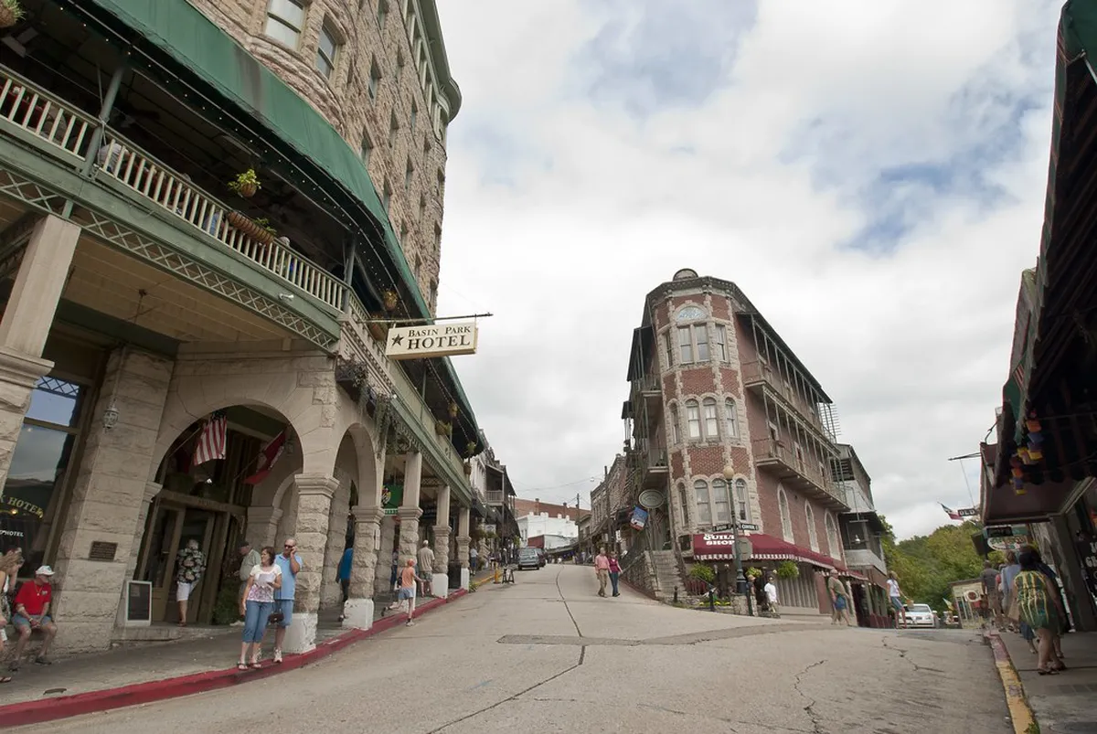
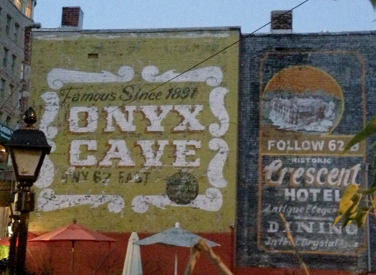
Rideshare coverage is thinner in Eureka Springs than in a larger city, so do not count on an Uber or Lyft showing up quickly, especially outside the downtown core. A local operator, Abundant Taxi & Executive Car Services, has historically listed a $3.50 pickup fee, $2.60 per mile, and a $2.00 charge per extra passenger. Confirm current pricing and availability directly before you rely on a local car service for an airport transfer. Some downtown properties soften the parking problem for guests. The Crescent Hotel and the Basin Park Hotel have both offered free shuttle service in the past, cutting out the need to drive downtown once you check in. Check with your Eureka Springs lodging pick before your trip, since shuttle availability and pickup points can change by season.
Parking and the Eureka Springs Trolley: Your Last-Mile Plan
Eureka Springs is built into limestone bluffs, and its historic downtown streets were laid out for foot traffic and horse carriages, not modern cars. Once you reach town, the single best strategy is to park at your hotel, motel, or bed and breakfast and leave the car there for the rest of the stay. Eureka Springs Transit runs the trolley system that most visitors use to move around the Victorian-era historic district instead of hunting for downtown parking. Its welcome center and ticket office sit at 137 W. Van Buren, on Highway 62 about a quarter mile west of the Highway 23N intersection. Staff there sell tickets and can also help with lodging and dining questions on the spot. For a fuller rundown of parking rules and downtown logistics, see the parking and transit tips guide. Confirm current trolley routes, fares, and off-season operating hours directly with the transit office before building a full day around it, since schedules can shift by season. Expect stair-step sidewalks and steep inclines between blocks, so pack footwear that can handle hills if you plan to walk instead of ride.
Buy trolley tickets at the welcome center, 137 W. Van Buren on Highway 62, before festival weekends when parking fills earliest in the day. Arriving before midday keeps the last-mile plan intact instead of circling for a spot outside downtown.
Timing Your Trip: Events, Itineraries, and Day Trips
Festival weekends add real friction to the transportation picture. During peak dates on the seasonal festival calendar, downtown parking fills earlier in the day, and trolley cars run fuller than usual. Plan to arrive before midday if you are driving in for a single event, or you may end up circling for a spot well outside downtown. Visitors following a compressed schedule, such as the 2-day itinerary, benefit from parking once and relying on the trolley, rather than moving a car through downtown traffic repeatedly. After parking is sorted for the historic district, having your own car still pays off for nearby day-trip options, since the trolley network is built for the historic district, not the surrounding Ozark countryside around Beaver Lake and the White River.
Common Mistakes to Avoid When Getting to Eureka Springs
A few recurring mistakes make the trip harder than it needs to be.
- Trusting GPS on unpaved mountain backroads: some shortcuts are unsuitable for low-clearance cars, so stick to the marked highway routes above.
- Expecting easy street parking downtown on a Saturday: arrive early, or plan to park at your lodging and walk or ride the trolley instead.
- Assuming trolley hours match the summer schedule during the off-season: confirm current hours before building a day around it.
- Treating the 45-minute airport drive time as guaranteed: budget extra time for winding two-lane roads, especially after dark.
Next Step: What to Do Once You Arrive
With transportation settled, turn to the top attractions guide to build out the rest of the visit. Pair it with the trolley schedule so each stop lines up with a route stop instead of a parking search.
Distance and Drive Time from Regional Hubs
Eureka Springs sits in the far northwest corner of Arkansas, so drive times vary widely depending on your starting city. None of these routes end on an interstate, so add extra time for the final two-lane stretch into town.
- Springfield, Missouri: about 95 miles, roughly 2 hours via Highway 65 and Highway 62.
- Tulsa, Oklahoma: about 115 miles, roughly 2.5 hours via Highway 412 and Highway 23.
- Little Rock, Arkansas: about 180 miles, roughly 3.5 to 4 hours via Highway 65.
- Kansas City, Missouri: about 215 miles, roughly 4 hours via Highway 71 and Highway 62.
Springfield and Tulsa make the most practical day-drive origins, while Little Rock and Kansas City trips usually mean an overnight stop is worth planning around. Google Maps and other GPS apps tend to underestimate these routes because they do not account for the hills and curves in the final approach. Build in a buffer past whatever time your map app shows, especially if you are driving after dark or during winter weather. Check road conditions before departure if snow or ice is in the forecast for the Ozarks.
Frequently Asked Questions
What is the closest airport to Eureka Springs?
Northwest Arkansas Regional Airport (XNA) and Branson Airport (BKG) are both roughly 45 to 50 miles away. Neither has a shorter, guaranteed drive, so choose based on flight availability and whether your route already runs through Missouri or northwest Arkansas.
Do you need a car in Eureka Springs?
You need a car to reach Eureka Springs from any airport or distant city, since no commercial airport sits in town. Once you arrive, park at your lodging and use the Eureka Springs Trolley for downtown, because the historic district was not built for driving or easy parking.
How much does a taxi cost in Eureka Springs?
One local operator, Abundant Taxi & Executive Car Services, has listed a $3.50 pickup fee plus $2.60 per mile, with a $2.00 charge for each extra passenger. Confirm current pricing directly before booking, since local rates can change.
Where do you buy Eureka Springs Trolley tickets?
The Eureka Springs Transit welcome center and ticket office sit at 137 W. Van Buren, on Highway 62 about a quarter mile west of the Highway 23N intersection. Staff there sell tickets and can answer route and schedule questions in person.
Is the drive to Eureka Springs difficult?
The final approach involves narrow, hilly roads. Highway 23 south of town, known as the Pig Trail, has tight switchbacks that can challenge large RVs or nervous drivers. Check seasonal road conditions before a winter trip, since steep hills can ice over.