12 Best Scenic Road Trips in America for 2026
Discover the best scenic road trips in America, from Route 66 and the Pacific Coast Highway to the Blue Ridge Parkway, Dalton Highway, and Utah red rock drives.
On this page
12 Best Scenic Road Trips in America for Mountains, Coasts, Deserts, and Big Cross-Country Drives
The best scenic road trips in America include the Pacific Coast Highway, the Blue Ridge Parkway, and Route 66 — the "Big Three" that anchor most itineraries — plus desert drives through Utah and Arizona, mountain passes in Montana and Wyoming, and remote routes like Alaska's Dalton Highway. This guide sorts all 12 by trip length, season, and vehicle.
National Scenic Byways are roads formally recognized for at least one of six qualities: scenic, historic, cultural, natural, recreational, or archaeological value. All-American Roads carry that same recognition at the program's top tier, reserved for routes considered destinations in their own right rather than a way to reach one. That distinction, tracked by the National Scenic Byway Foundation, is part of why some of the best drives in the USA show up on official byway maps while an equally scenic local road may not. Use this road trip planning guide as a starting map, then check official road, park, and weather notices before you book lodging or campsites.
Free guide: 12 Small-Town Weekend Escapes
A practical starter list of character-filled U.S. towns, the best season to visit, and the trip shape that suits each one.
How to Choose the Best Scenic Road Trips in America
Start with time, season, and vehicle limits. A cross-country route can need 2 weeks or more. A regional route can work in 3 to 5 days. The Scenic Byways program is useful when you want roads recognized for scenic, cultural, historic, natural, recreational, or archaeological value. The National Park Service road pages are also important because park roads can close, restrict vehicle size, or require seasonal access planning.
| Decision | Best fit | Watch for |
|---|---|---|
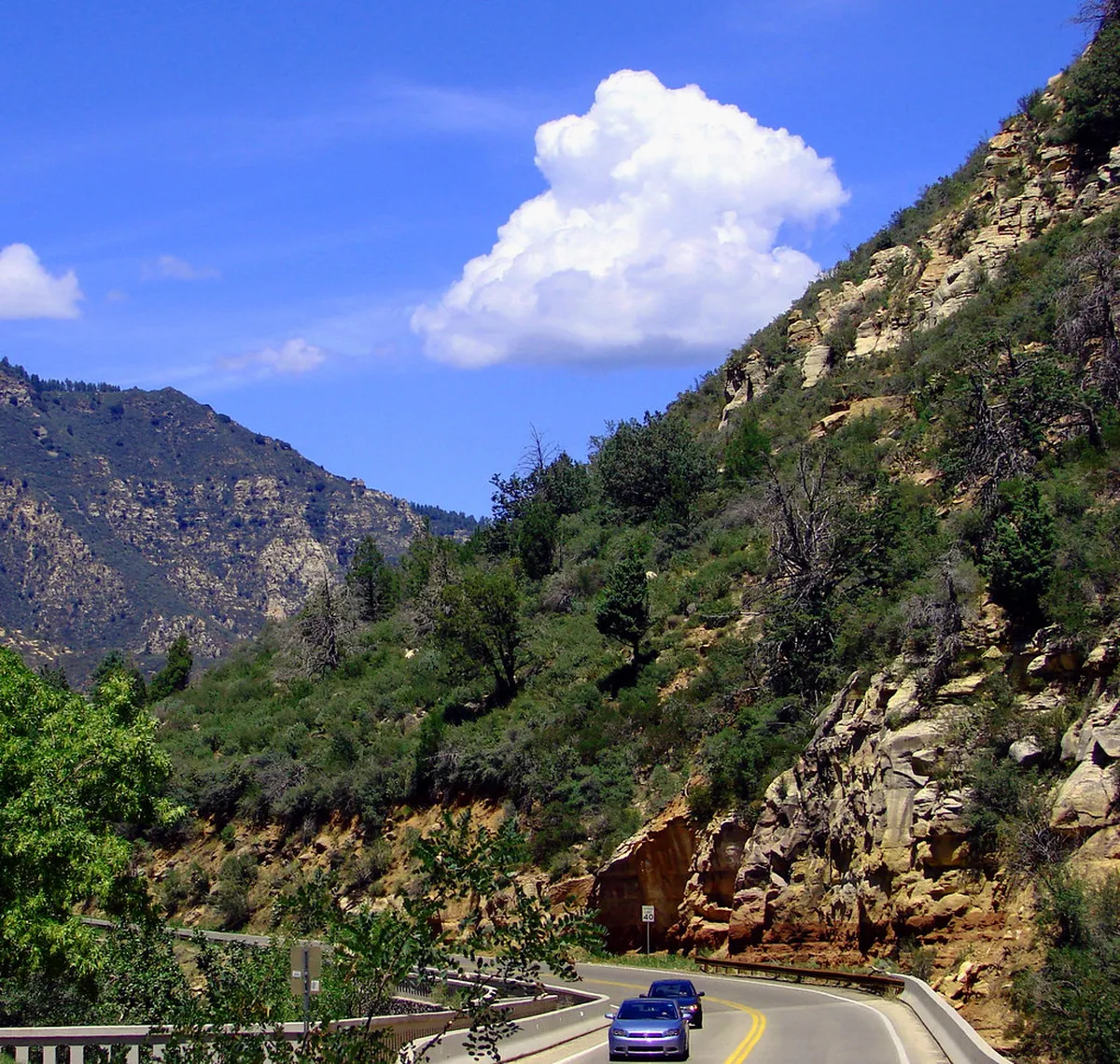
| You have 3 to 5 days | Blue Ridge Parkway, Pacific Coast Highway, Beartooth Highway, Sedona to Grand Canyon | Shorter daylight in winter and limited lodging in small towns |
| You have 2 weeks or more | Route 66, Great Northern, Loneliest Road, Great River Road | Long empty stretches and more fuel planning |
| You drive an RV | Great River Road, Route 66, Pacific Coast Highway sections, Blue Ridge Parkway with clearance checks | Tunnel heights, steep grades, narrow curves, and park vehicle limits |
| You want remote adventure | Dalton Highway, Beartooth Highway, US-50 in Nevada | Sparse services, truck traffic, weather shifts, and roadside repair gaps |
| You want fall color | Blue Ridge Parkway, Great River Road, Great Northern, New England add-ons | Peak foliage timing changes by elevation and latitude |
12 Best Scenic Road Trips in America
The list below mixes US cross-country routes such as Route 66 and the Great Northern with regional pillars like the Pacific Coast Highway and Blue Ridge Parkway, plus desert loops and a few deliberately remote alternatives. Some are paved national icons; others are highways where preparation matters more than sightseeing stops. Use the details under each entry to match the route to your available time, vehicle, and tolerance for isolation.
- 1. Pacific Coast Highway, California and the West Coast
- Choose the Pacific Coast Highway when you want ocean cliffs, small coastal towns, redwood detours, and a slower pace than an interstate drive.
- Road Trip USA frames the broader Pacific Coast route as a 1,650-mile drive from Washington to California, while California's own Route 1 runs more than 600 miles from Dana Point to Leggett.
- Build extra time around Big Sur, Bixby Creek Bridge, Hearst Castle, Solvang, and redwood country, and use West Coast routes if you want more Pacific alternatives.
- 2. Blue Ridge Parkway, Virginia and North Carolina
- Pick the Blue Ridge Parkway when you want a mountain drive designed for slow travel, overlooks, mill stops, and fall color.
- The parkway runs 469 miles between Shenandoah National Park and Great Smoky Mountains National Park, with a 45 mph speed limit that keeps the drive slow by design.
- RV travelers should check tunnel clearance before committing, and fall planners can compare this route with fall road trips and Southern drives.
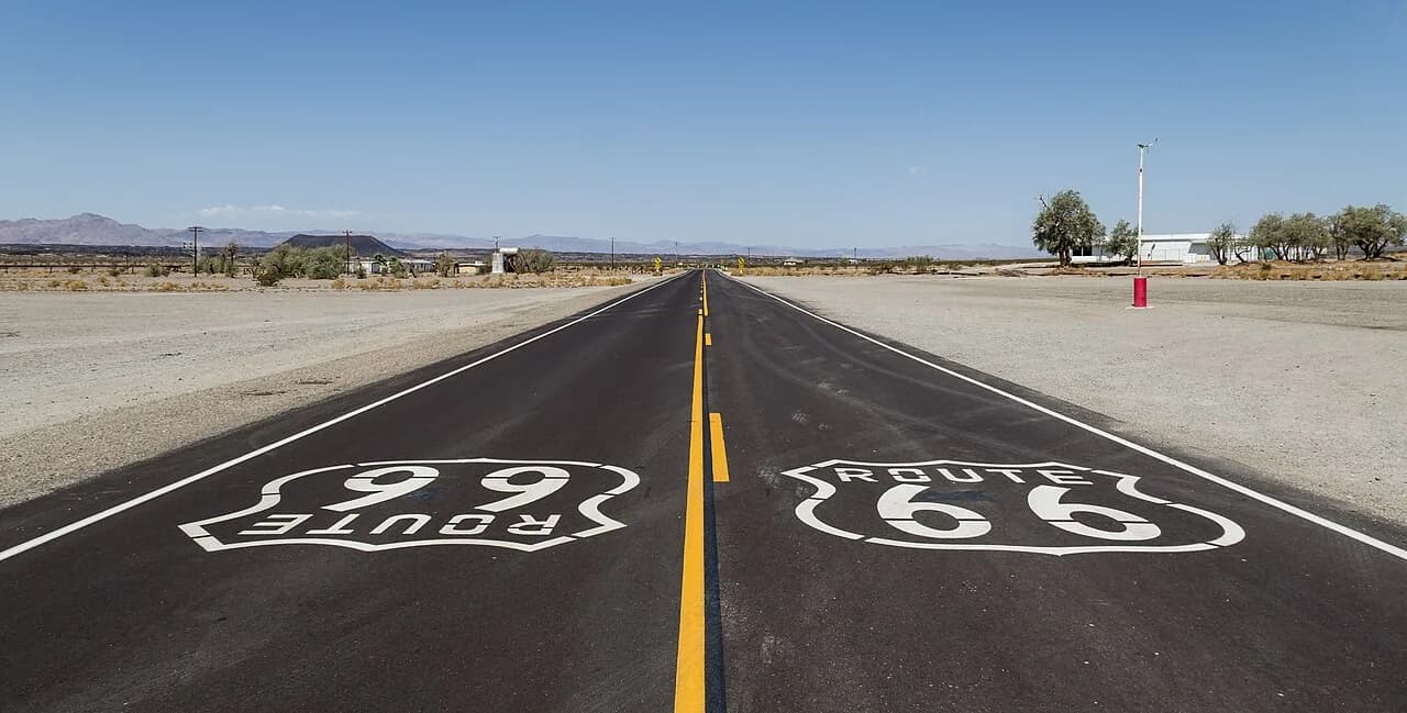
- 3. Route 66, Illinois to California
- Route 66 fits travelers who want diner signs, roadside museums, desert towns, neon, and a historic highway story more than untouched wilderness.
- The historic route runs 2,448 miles from Chicago, Illinois, to Santa Monica, California.
- Plan it as a multi-state cultural drive with stops such as Pontiac, Cadillac Ranch, Petrified Forest National Park, and Santa Monica Pier.
- 4. Going-to-the-Sun Road, Montana
- Going-to-the-Sun Road is best for a short, high-impact mountain crossing inside Glacier National Park.
- The road covers 50 miles through Glacier National Park, and RVs over 20 feet are not recommended on its narrower sections.
- Glacier National Park has used seasonal vehicle reservation requirements on this corridor in recent years, so check current access rules before you build a fixed itinerary.
- 5. Beartooth Highway, Montana and Wyoming
- Beartooth Highway suits confident mountain drivers who want high-elevation scenery and a gateway approach to Yellowstone.
- The route covers 68 miles between Red Lodge, Montana, and Yellowstone's northeast entrance, climbing over Beartooth Pass at 10,947 feet.
- Beartooth Highway typically opens around Memorial Day and closes by mid-October, though snow can shift those dates in either direction, so check current conditions before setting out.
- 6. Utah Mighty 5 and Scenic Byway 12
- Use this route when red rock landscapes matter more than one named highway.
- Utah's Mighty 5 national parks anchor this desert trip, with Scenic Byway 12 carrying All-American Road status as the connective route through the red rock.
- Arches and Canyonlands pair well from the Moab area, but timed-entry rules can change, so verify park access before building fixed reservations.
- 7. Dalton Highway, Alaska
- Dalton Highway is the outlier on this list because it is a serious remote drive, not a casual vacation road.
- The highway runs 415 miles from Fairbanks to Deadhorse near the Arctic Ocean, with Coldfoot as one of the only fuel and food stops along the way.
- Expect truck traffic, long unpaved stretches, sparse services, and real repair risk — much of the route remains ungraded gravel, and conditions shift with weather and maintenance, so check current road reports before committing.
- 8. Great River Road, Mississippi River
- Great River Road works for travelers who want history, river towns, state-by-state variety, and a less extreme driving experience than Alaska or high mountain passes.
- The route runs 2,340 miles through 10 states, from Minnesota to Louisiana.
- Build the trip around Lake Itasca, the Twin Cities, Hannibal, Vicksburg National Military Park, and Delta stops, then compare more regional ideas in Midwest road trips.
- 9. The Great Northern, US-2
- The Great Northern is a cross-country choice for travelers who want the Great Lakes, northern plains, mountain passes, and Cascades in one long route.
- Its main appeal is the transition itself — Great Lakes shoreline giving way to northern plains, then mountain passes, then the Cascades, all in one continuous cross-country drive.
- Prepare for long stretches between major hubs, and plan fuel, lodging, and weather checks more carefully than you would on a short coastal drive.
- 10. The Loneliest Road, US-50
- US-50 is best for travelers who want open-space driving and do not mind long quiet sections.
- The Nevada stretch and its Loneliest Road Passport program give the route its signature planning hook — a stamp book that rewards drivers for taking on the emptiness rather than avoiding it.
- Carry water, food, and a fuel margin — on US-50, the boredom factor is also a logistics issue, since long stretches pass with no services at all.
- 11. Sedona to the Grand Canyon, Arizona
- This route is a practical Southwest option when you want red rock scenery and Grand Canyon viewpoints without committing to a full Utah loop.
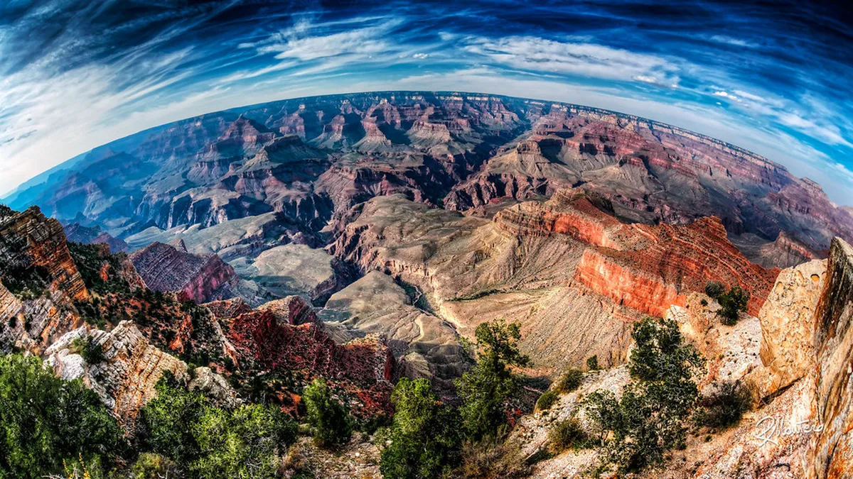
- Desert View Drive along the South Rim is the key Grand Canyon detail here, and monsoon season can turn a simple viewpoint drive into a lightning-and-downpour delay through midsummer.
- Check current park alerts before departure, because storms, lightning, and road work can change a simple viewpoint drive.
- 12. North Shore Scenic Drive, Minnesota
- Choose the North Shore Scenic Drive when you want a shorter northern route tied to Lake Superior rather than a coast-to-coast itinerary.
- The route runs from Duluth to Grand Portage at the Canadian border, tracing Lake Superior's shoreline the whole way.
- This is a good add-on to a Great River Road or Great Lakes plan, especially when you want a cooler-weather alternative to desert drives.
Route Planning by Season
Season can matter more than mileage on these drives. Summer favors high roads such as Going-to-the-Sun Road and Beartooth Highway, but those routes still need current road checks. Fall points many travelers toward the Blue Ridge Parkway, Great River Road, and northern lake routes. Desert routes can be easier outside peak heat, but monsoon season still carries real risk around Sedona and the Grand Canyon through the summer months.
For 3 to 5 days, choose a regional route and let season narrow the shortlist: winter cuts daylight, spring can delay mountain openings, and fall color timing shifts by elevation and latitude.
| Season | Strong choices | Main planning issue |
|---|---|---|
| Spring | Pacific Coast Highway, Route 66, Great River Road | Mountain roads may still face snow or delayed openings |
| Summer | Going-to-the-Sun Road, Beartooth Highway, Great Northern | Reservations, traffic, storms, and high-elevation weather |
| Fall | Blue Ridge Parkway, Great River Road, North Shore Scenic Drive | Foliage timing varies, and lodging can fill in peak areas |
| Winter | Route 66 desert sections, lower-elevation Southwest routes | Short daylight and possible mountain closures |
Car, SUV, or RV: What Changes
Vehicle choice can eliminate routes before scenery does. A regular car works for paved classics such as Route 66, much of the Pacific Coast Highway, the Great River Road, and many Blue Ridge Parkway sections. SUVs add comfort on rough approaches, but they do not remove the need for road-condition checks. RV drivers should be more selective, since tunnel clearance on the Blue Ridge Parkway and the vehicle-size caution on Going-to-the-Sun Road can rule out a route before scenery ever enters the decision.
Picture the spectrum with the Blue Ridge Parkway at one end — paved, speed-limited to 45 mph, built for comfort — and Dalton Highway at the other, where long unpaved stretches, heavy truck traffic, and no cell service test the vehicle and the driver alike. Most of the routes on this list sit somewhere between those two extremes, and knowing where your own comfort level falls narrows the shortlist faster than mileage or scenery ever will.
RV-friendly does not mean every scenic road is easy. Going-to-the-Sun Road is flagged for vehicles over 20 feet, while Blue Ridge Parkway planning still depends on tunnel clearance, grades, and route checks.
- Best for regular cars
- Route 66, Great River Road, Pacific Coast Highway, and many regional byways are the easiest starting points.
- Best for RVs with careful checks
- Blue Ridge Parkway and Pacific Coast Highway can work, but tunnel heights, pullouts, grades, and town parking need review.
- Best for high-clearance confidence
- Dalton Highway demands more preparation than any other route on this list — gravel sections, heavy truck traffic, sparse services, and long distances between towns all add up.
Budget and Booking Reality
Exact daily costs shift too often with season, fuel prices, and lodging demand to quote a fixed number here, so compare costs by trip type instead. A coastal run on the Pacific Coast Highway typically costs more per day than a Great River Road trip through the Midwest, mainly because coastal lodging and parking carry higher demand pricing while river towns keep rooms, campgrounds, and diners more affordable. River and Midwest routes often give you more small-town options at a lower nightly cost. National park routes need earlier planning regardless of budget, because campsite, permit, timed-entry, and road-access rules can change by season.
| Cost pressure | Higher-risk routes | Lower-stress alternatives |
|---|---|---|
| Lodging demand | Pacific Coast Highway, Glacier area, Grand Canyon area | Great River Road towns and Route 66 towns away from major hubs |
| Vehicle wear | Dalton Highway and high mountain passes | Blue Ridge Parkway, Great River Road, Route 66 |
| Access planning | Going-to-the-Sun Road, Arches, and other timed-entry park routes | State byways and non-park scenic roads |
| Fuel anxiety | US-50 in Nevada and Dalton Highway | Shorter regional routes with frequent towns |
Anti-Mistake Checklist Before You Drive
Do the boring checks before the scenic part starts. Confirm road status for mountain and park routes. Review any vehicle reservation or timed-entry rule for Glacier, Arches, and other national park drives. Screenshot maps for remote areas such as Dalton Highway and US-50. Tell someone your route when services are sparse. If you are building a regional trip, compare related guides for East Coast drives, West Coast drives, and Midwest drives.
- Check road status
- Mountain roads can close or restrict access when snow, rockfall, fire, or construction affects the route.
- Verify park access
- Do this before lodging locks you into dates, especially near Glacier, Arches, and the Grand Canyon.
- Plan fuel gaps
- Remote routes such as Dalton Highway and US-50 need fuel margin, food, water, and offline navigation.
- Match route to daylight
- Short winter days make viewpoint-heavy routes harder, even when the road itself remains open.
Long, empty stretches deserve their own prep, not just fuel math. US-50 in Nevada and long-haul plains highways like US-83 can run for hours between towns, and the monotony itself becomes a driving hazard once attention starts to drift. Download music, podcasts, or offline maps before you lose signal, plan driver swaps on multi-day legs, and build in stops even when nothing on the map looks worth stopping for.
Camping and Boondocking Strategy
Camping logistics can shape the whole route, especially near Glacier, Arches, Grand Canyon, Yellowstone, and Big Sur. National park campgrounds often book early, while first-come sites can fill before midday in peak season.
For more flexibility, look beyond park boundaries. National forests and Bureau of Land Management areas often allow dispersed camping where posted rules permit it. This works best on routes near Utah's Scenic Byway 12, Arizona red rock country, and parts of the Great Northern.
- Check the managing agency before you camp, because fire bans, stay limits, and road closures change by district.
- Carry extra water and a trash plan, especially on desert and high-plains routes with few services.
- Use established pullouts or durable surfaces; do not create new tracks beside scenic roads.
RV travelers should also plan dump stations, potable water, and battery charging. Free campsites are useful, but they add research, driving time, and responsibility.
That trade runs both ways. Skipping campground fees usually means finding your own water, managing battery power, and locating a dump station days apart, and the labor adds up on a long trip. Some travelers treat that as the price of freedom and build their whole route around it; others decide after a week that a booked site with hookups is worth the fee, and there is no wrong answer between the two.
Mapping Your Route: Fall, Summer, and What to Book First
Season decides more of this shortlist than any other factor, so it is worth naming a default. For a fall trip, the Blue Ridge Parkway is the strongest single pick on this list — paved, slow by design, and timed to peak Appalachian foliage — with the Great River Road and North Shore Scenic Drive as strong regional alternatives. For a summer trip, Going-to-the-Sun Road and Beartooth Highway open their full route only in the warmer months, which makes summer the one season when Montana and Wyoming's high mountain passes are fully in play. Readers building a color-focused itinerary should compare this list against dedicated fall road trips in America coverage before locking dates.
Book national park lodging and campsites first, since those fill fastest and anchor everything else on the itinerary. Then confirm vehicle and season restrictions for any mountain pass or park corridor on the route. Everything else — diner stops on Route 66, overlooks on the Blue Ridge Parkway, river towns along the Mississippi — can flex once the fixed pieces are locked in. That booking order, more than any single route pick, is what separates a smooth trip from a stressful one.
Frequently Asked Questions
What is the best scenic road trip in America for first-time travelers?
The Blue Ridge Parkway is one of the easiest first choices because it is scenic, paved, and built for slower travel. The Pacific Coast Highway is another strong option if you want ocean views and coastal towns.
How many days do you need for a scenic road trip in the United States?
Plan 3 to 5 days for a regional route such as the Blue Ridge Parkway or a California coast segment. Plan 2 weeks or more for Route 66, the Great Northern, or another cross-country route.
Which scenic road trips are best for RV travelers?
Great River Road and Route 66 are usually easier RV starting points than narrow mountain roads. Blue Ridge Parkway and Pacific Coast Highway can work, but you should check tunnel clearances, grades, parking, and seasonal restrictions.
Which scenic road trip is best for fall color?
Blue Ridge Parkway is the classic fall choice because the route runs through Virginia and North Carolina mountains. Great River Road and North Shore Scenic Drive also work well when you want river towns or Lake Superior scenery.
Is Dalton Highway worth driving?
Dalton Highway is worth considering only if you want a remote Alaska challenge. It is not a casual sightseeing road, and the 415-mile route has gravel, truck traffic, sparse services, and repair risk.
Do national park scenic drives require reservations in 2026?
Some park drives may require timed entry, vehicle reservations, or seasonal access planning. Check the official park page before booking lodging, especially for Going-to-the-Sun Road, Arches, and other high-demand routes.
Explore More America Guides
Keep planning your America trip with these guides.
America Guides
Free guide: 12 Small-Town Weekend Escapes
A practical starter list of character-filled U.S. towns, the best season to visit, and the trip shape that suits each one.
You might also like


Continue reading
More guides you'll find useful