
Best Day Trips from Taos for Scenic Drives, Hot Springs, and Mountain Towns
Last updated August 2026, the best day trips from Taos work when you match the route to the season, road conditions, and your energy. Use Taos as your base, then choose between the High Road, the Rio Grande Gorge, Ojo Caliente, Taos Ski Valley, or a longer push to Great Sand Dunes National Park. For a tighter home base plan, pair this guide with where to stay before you commit to early starts.
How to Choose Day Trips from Taos
Taos day trips spread in three useful directions. South sends you toward Santa Fe, Chimayo, Cordova, Truchas, and the High Road villages. West leads to the Rio Grande Gorge, Earthship Biotecture, and Ojo Caliente. North takes you toward Arroyo Seco, Taos Ski Valley, the Enchanted Circle, and Colorado's Great Sand Dunes. Start with drive time, then choose the kind of day you want. A 30-minute outing can still include mountain air, shops, and lunch. A 90-minute route asks for fuel, daylight, and fewer stops. A 2-hour drive to Colorado needs an early start and a weather check. Use the official Taos tourism site for current local status before you leave. Use New Mexico travel planning pages for statewide route context. If this is your first stay, keep one day centered on town. The main sights in things to do near Taos deserve time without a long drive attached.
Plan by effort, not just direction: the 84-mile loop needs clear mountain roads, fuel, and downloaded maps, while nearby Taos Pueblo can still be unavailable when ceremonies close visitor access.
| Route | Best For | Typical Drive Frame | Best Decision |
|---|---|---|---|
| High Road to Santa Fe | Churches, galleries, artisan villages | About 90 minutes to Santa Fe without long stops | Go south on the High Road when scenery matters |
| Low Road along the Rio Grande | River views and a faster return | About 90 minutes between Taos and Santa Fe | Use it for the return leg after a High Road morning |
| Rio Grande Gorge and Ojo Caliente | Gorge walks, bridge views, soaking | About 45 minutes to Ojo Caliente | Pair a short gorge stop with a later soak |
| Enchanted Circle Scenic Byway | Mountain towns and alpine scenery | 84-mile loop | Choose it when roads are clear and you want a full loop |
| Taos Ski Valley and Arroyo Seco | Short mountain day | About 30 minutes to Taos Ski Valley | Use this when you want less driving |
| Great Sand Dunes National Park | Colorado dunes and Medano Creek season | About 2 hours each way | Start early and avoid hot sand periods |
The High Road to Santa Fe and the Low Road Return
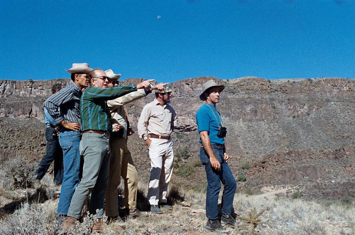
Santa Fe is the classic long day from Taos, but the route matters as much as the destination. The High Road is the scenic choice. It links small villages, churches, galleries, and high-country views between Taos and Santa Fe. Chimayo gives you El Santuario de Chimayo. Cordova is associated with artisan work and weaving. Truchas adds mountain village scenery on the way south. Keep the pace realistic. One church, one gallery stop, and one meal can fill the drive before Santa Fe. Add downtown Santa Fe only if you leave Taos early. The Low Road follows the Rio Grande corridor and works better as the return route. It trades gallery stops for river driving, with Dixon and Velarde winery stops along the way, and it generally feels faster than the High Road. A practical loop is simple. Take the High Road south when you are fresh. Use the Low Road north when daylight is fading. This gives you both road experiences without doubling back. Drivers who dislike winding village roads should reverse the priority and keep the day shorter. Snow, storms, and road work can change the best route. Check road status before leaving Taos, especially outside summer. For a short visit, this loop pairs well with a separate 2-day itinerary that keeps another day close to town.
- Leave Taos early if Santa Fe is part of the same day.
- Use Chimayo as the anchor stop on the High Road.
- Keep Cordova and Truchas as short art and village stops.
- Return on the Low Road when you want river scenery and fewer detours.
- Carry fuel before you leave Taos because cell service can drop on rural stretches.
The Enchanted Circle Scenic Byway North of Taos
The Enchanted Circle Scenic Byway is the strongest full-day mountain loop from Taos. The route is an 84-mile loop through Eagle Nest, Angel Fire, Red River, and Questa. It circles Wheeler Peak, New Mexico's tallest mountain, in the Sangre de Cristo Mountains, and moves through valleys, forest, and mountain towns. Choose this route when you want a driving day with several short stops, not one single attraction. Angel Fire gives you the Vietnam Veterans Memorial State Park stop. Red River works for a walk and meal break. Questa keeps the northern side of the loop from feeling like a straight out-and-back. Wheeler Peak views are the constant thread, but do not plan around one exact viewpoint unless you have mapped it before leaving. Conditions matter here. Winter snow can slow the loop. Summer storms can still change the mood quickly at elevation. Fuel before the loop, then download maps, since much of the route crosses Carson National Forest, where cell coverage can be thin in wooded, mountain stretches. If you want a lower-effort mountain day, skip the full circle and drive only toward Arroyo Seco or Taos Ski Valley. That keeps you within about 30 minutes of Taos instead of turning the day into an 84-mile loop. For weather timing, compare this plan with best time to visit guidance before choosing your date.
- Best route style: full scenic loop.
- Core towns: Eagle Nest, Angel Fire, Red River, and Questa.
- Named stop: Vietnam Veterans Memorial State Park in Angel Fire.
- Key planning number: 84 miles for the loop.
- Main caution: snow, mountain weather, fuel, and weak cell service.
Rio Grande Gorge Bridge, Earthship Biotecture, and Ojo Caliente
West of Taos gives you a flexible day because the stops can be short or slow. Rio Grande Gorge Bridge is the easiest anchor. Parking at the rest area west of the bridge gives access to a 6-mile out-and-back rim trail, an easy walk or ride along the canyon edge within the Rio Grande del Norte National Monument. Use that as a short walk, a sunset stop, or the start of a longer gorge day. Watch for bighorn sheep from safe pullouts and trail areas, but keep expectations loose. Wildlife sightings are never guaranteed. Hikers who want more than a stroll can look for the River Trail and Little Arsenic Trail farther into the monument, which connect into a moderate river-and-gorge route without committing to a full backcountry outing. River-level access is the part many travelers underestimate. Driving down into canyon and river areas can require high-clearance or 4WD. Do not take a low-clearance rental onto rough access roads just because a map shows a route. Earthship Biotecture World Headquarters can fit into the same westward plan if current tours are available. Check status before building the day around it. Ojo Caliente hot springs sits about 45 minutes from Taos and changes the pace from driving to soaking. Treat it as the soft landing after the gorge. Ojo Caliente offers both primitive and more developed mineral-soaking options, so choose based on comfort, access, and current booking rules. Avoid naming a current pool, package, or ticket unless you have checked the direct operator that day.
| Stop | Use It For | Planning Note |
|---|---|---|
| Rio Grande Gorge Bridge | Bridge views and rim walking | Rest area parking sits just west of the bridge |
| Rim trail | Easy out-and-back walking or biking | Runs about 6 miles out-and-back along the rim |
| River Trail / Little Arsenic Trail | Moderate hike closer to the river | Within Rio Grande del Norte National Monument; more effort than the rim trail |
| River-level gorge roads | Closer river access | High-clearance or 4WD may be needed |
| Earthship Biotecture | Off-grid architecture tours | Check current tour status before leaving Taos |
| Ojo Caliente | Mineral soaking | About 45 minutes from Taos |
Great Sand Dunes National Park as a Long Day Trip
Great Sand Dunes National Park is possible from Taos, but it is not a casual add-on. Plan on a drive time of about 2 hours each way. That means at least 4 hours of driving before you count food, fuel, park time, and border weather. Start early if this is your target. Keep the schedule simple once you arrive. Sand, creek, and short walks are enough for a day trip. Medano Creek is the seasonal detail to watch, and late spring is the key flow period to plan around. Outside that window, the creek may not match photos you have seen. Sand temperature is the other major issue. Avoid long barefoot walks during hot periods, and carry more water than you expect to use. The drive crosses from New Mexico into Colorado, so forecast checks should cover both sides of the route. Do not tack this onto a night with a fixed dinner reservation in Taos. One delay can make the return feel rushed. Great Sand Dunes works best when you have already seen the core Taos sights and want one big landscape day. If you only have a weekend, the Enchanted Circle usually fits better.
- Drive frame: about 2 hours each way from Taos.
- Seasonal detail: Medano Creek is most relevant in late spring.
- Main risk: hot sand and exposed walking.
- Best schedule: early start, simple park plan, flexible dinner.
- Skip it when snow, storms, or heat make the drive less useful.
Local Gems Within 30 Minutes of Taos
Short trips can save a Taos itinerary from too much windshield time, and they answer most of what people search for in things to do near Taos without a long drive. Arroyo Seco is the easiest small-town detour between Taos and Taos Ski Valley. Aceq and Manzanita Market are well-known food stops there, and Arroyo Seco also works for shopping. Verify current hours before you aim a meal there. Small restaurants can change schedules by season. Taos Ski Valley is about 30 minutes from town. In winter, it anchors a ski day. In warmer months, it becomes the approach for summer hiking, including the Williams Lake area. Match the activity to your fitness and conditions. Elevation makes short hikes feel harder than they look on a map. Taos Pueblo is even closer to town, but it needs different planning. Cultural significance, visitor etiquette, and seasonal access all shape a Pueblo visit. Ceremony closures happen at points during the year, including a window in March, so confirm status before you leave. Check current status before you leave, then confirm visitor fees and photography permit rules. Do not treat Taos Pueblo like a backup stop if the official visitor status is uncertain. For more close-in choices, build around Taos attractions before adding a second destination.
- Arroyo Seco: shopping, Aceq, and Manzanita Market, subject to current hours.
- Taos Ski Valley: about 30 minutes from Taos for skiing or summer hiking.
- Williams Lake area: a summer hiking target when conditions allow.
- Taos Pueblo: check visitor status, fees, and photo permit rules before going.
- March caution: Pueblo ceremony closures can occur during part of March.
Taos Pueblo Etiquette and Access Planning
Taos Pueblo deserves more planning than its short distance suggests. It is a living community, not a museum stop built around visitor convenience. Check the current visitor status before leaving your lodging. Ceremony closures can happen, and March is a known period to watch. Ask about current visitor fees before arrival. Confirm whether photography permits are available and where cameras are restricted. Rules can change by date, ceremony, and community needs. Respect closed areas without asking for exceptions. Shop only where visitor access is allowed. Keep voices low near homes and ceremonial spaces. Avoid photographing residents unless permission is clear. If the Pueblo is closed, do not force a substitute narrative onto the day. Use that time for San Francisco de Asis Mission Church, Taos Plaza, or a museum in town. That keeps the plan respectful and avoids wasted driving. Taos Pueblo also pairs better with a local day than with Santa Fe or Great Sand Dunes. Leave enough time to slow down and follow posted rules.
A local day is not automatically low-effort. Taos sits above 7,000 ft, so even close stops pair better with water, sun protection, flexible timing, and a backup plan if Pueblo access is closed.
- Check same-day visitor status before departure.
- Confirm the current visitor fee before arrival.
- Ask about photography permit rules before taking photos.
- Expect ceremony closures, especially around the March period.
- Use town sights as a backup if visitor access is closed.
Common Mistakes to Avoid on Taos Day Trips
The biggest mistake is planning by mileage alone. Mountain roads, village stops, weather, and altitude change the day quickly. A 30-minute drive to Taos Ski Valley can feel like a full outing if you hike. A 90-minute Santa Fe drive can turn into a long loop when you add Chimayo, Cordova, and Truchas. A 2-hour push to Great Sand Dunes needs nearly a whole day. Build one anchor stop and one backup stop. Skip the third stop when daylight runs short. Hydration matters because Taos sits above 7,000 ft in the high desert. Sun exposure can feel stronger than the air temperature suggests. Carry water, layers, and sun protection even on cool days. Fuel and maps matter on the High Road and Enchanted Circle. Do not count on continuous cell service. Vehicle choice matters near the Rio Grande Gorge. Stay on suitable roads unless you have high-clearance or 4WD. Seasonal closures matter at Taos Pueblo and in mountain areas. Before locking a route, compare weather with Taos seasons and keep dinner plans flexible.
| Mistake | Why It Matters | Better Move |
|---|---|---|
| Adding too many stops | Routes stretch when you add galleries, meals, and photo stops | Choose one anchor and one backup |
| Ignoring altitude | Taos sits above 7,000 ft | Carry water, layers, and sun protection |
| Relying on cell service | High Road and mountain areas can have gaps | Download maps before leaving town |
| Driving rough gorge roads casually | River-level access may need high-clearance or 4WD | Stay on roads that match your vehicle |
| Assuming Taos Pueblo is open | Ceremonies can close visitor access | Check same-day status before going |
Best Day Trip Pairings for a Taos Weekend
A short Taos stay works best when you avoid stacking two long routes back to back. Pair one ambitious loop with one close-in day. The High Road and Low Road loop fits travelers who want churches, galleries, and Santa Fe in one long outing. Follow it with Arroyo Seco, Taos Ski Valley, or Taos Pueblo if visitor access is open. The Enchanted Circle pairs well with a lighter day around Taos Plaza and the Rio Grande Gorge Bridge. Ojo Caliente works best after a shorter outdoor morning, not after a 2-hour drive from Colorado. Great Sand Dunes should stand alone as the longest day. Do not combine it with the Enchanted Circle unless you are only passing through and skipping most stops. If you have two nights, protect your first evening. Arrive, settle in, and eat close to Taos. Use the next morning for the longest route. Save the final day for a 30-minute outing or core Taos sights. For a broader base plan, start with the Taos weekend guide, then use this article to choose the side trip.
- Best art route: High Road south and Low Road back.
- Best mountain route: Enchanted Circle Scenic Byway.
- Best low-drive day: Arroyo Seco plus Taos Ski Valley.
- Best relaxation pairing: Rio Grande Gorge Bridge plus Ojo Caliente.
- Best big landscape day: Great Sand Dunes National Park alone.
Low Road Stops: Dixon, Velarde, and Embudo
The Low Road is more than a fast return from Santa Fe. It follows the Rio Grande corridor through small agricultural communities, river bends, and roadside tasting rooms. Use it when you want a calmer drive back to Taos after the High Road villages.
Dixon is the best-known stop for food, galleries, and local wine country. Velarde sits farther south in the river valley and works for fruit stands or winery stops when they are open. Embudo is useful as a short pause near the river before the road climbs back toward Taos.
- Best use: return route after Chimayo, Cordova, Truchas, or Santa Fe.
- Good stops: Dixon, Velarde, Embudo, and Rio Grande pullouts.
- Main caution: hours vary, so check wineries and restaurants before relying on them.
Frequently Asked Questions
What is the best day trip from Taos for first-time visitors?
Choose the Rio Grande Gorge Bridge and Ojo Caliente if you want a flexible first day. The gorge gives you a short, named stop near Taos. Ojo Caliente adds a slower finish about 45 minutes from town.
Can you visit Santa Fe as a day trip from Taos?
Yes, Santa Fe works as a day trip from Taos if you start early. Plan on about 90 minutes between Taos and Santa Fe. Take the High Road for scenery and villages, then return on the Low Road for the river route.
Is the Enchanted Circle worth a full day?
Yes, the Enchanted Circle is worth a full day when roads are clear. The loop is 84 miles and includes Eagle Nest, Angel Fire, Red River, and Questa. Keep stops short if you want to complete the full route comfortably.
Do you need 4WD for day trips from Taos?
Most paved routes do not require 4WD in normal conditions. Rough access roads near the Rio Grande river level can require high-clearance or 4WD. Avoid those roads unless your vehicle and rental agreement allow them.
Can you visit Great Sand Dunes National Park from Taos in one day?
Yes, but it is a long day. Plan on about 2 hours each way from Taos. Start early, watch sand temperature, and check the Medano Creek season if that is part of your plan.
Should I plan Taos Pueblo as a backup stop?
No, treat Taos Pueblo as a planned cultural visit. Check current visitor status, fees, and photography rules before leaving. Ceremony closures can affect access, and March is a known closure period.


